|
Updated: @
10-23-2026 3:45am - next update at 12:00am
|
| Summary / Temperature |
Wind |
Rain/Melted Snow |
Cloud Level
|

|
Overcast
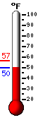
51.0°F

---
|
|
Feels like:
51°F
24-hr
difference
-1.2°F |
| LOCALLY: |
Today |
Yesterday |
| High: |
56.5°F
12:00am |
83.5°F
2:20pm |
| Low: |
51.0°F
3:40am |
48.9°F
8:08am |
|
|


|
NE
0.0
Gust:
0.0
|
|
Calm
|
| 60-Min Avg: |
Calm |
| 120-Min Avg: |
Calm |
| Max Gust: |
0.0 mph
1:07pm
|
| Month: |
17.0 mph Oct 16
|
|
| Today: |
0.00 in
|
| Yesterday: |
0.00 in
|
Last
Rain: |
10/4/2026
9:04 AM |
| October: |
1.45 in
|
| Last 7 Days: |
0.34 in |
| Rain Season:1 |
26.34 in
|
| Rain Days: |
69 in 2026
|
|
16 days since last rain. |
|
|
| Barometer ( inHg) |
Humidity/Dew Point |
Moon |
| Current: |
30.180 inHg
|
| 1-Hr Trend: |
Steady
|
| 3-Hr Trend: |
Steady |
|
High:
30.187 | Low:
30.172
|
|
| Humidity: |
71 %
 |
| Humidex: |
50.0°F
|
| Dew Point: |
41.9°F
|
| Wetbulb: |
46.8°F
|
|
|
Waxing Gibbous |

|
90%
Illuminated
|
|
| UV Forecast |
Solar Information |
|
|
| Sunrise is at:
7:25 am |
| Solar Noon:
12:59 |
| Sunset is at:
6:33 pm |
|
|
Wind Chill |
Heating Degree Days |
Sun |
| Current: |
51.0°F
|
| Today: |
51.0°F
at 3:40am
|
| Yesterday: |
48.9°F |
| Last Week: |
45.5°F |
| Record: |
43.0°F
10-18-2026
|
|
| Today: |
1.5 |
| October: |
32.6 |
| 2026 to Date: |
1054.5 |
|
Cooling Degree Days |
| 2026 to Date: |
2635.0 |
|
Daylight:
 11:08 11:08
-00:01:51 Min
|
|
| Almanac |
|
Station All Time Records |
Fire Risk4 |
| Sunrise: |
7:25am |
| Sunset: |
6:33pm |
| Moonrise: |
5:02pm |
| Moonset: |
4:43am |
| Full Moon: |
October 26 2026 |
| New Moon: |
07:03 UTC November 9 2026 |
|
| Outside Now |
| Air Density: |
1.25 kg/m3 |
|
| HIGHS: |
LOWS: |
99.7°F
09-22-2026
|
43.0°F
10-18-2026
|
| Daytime Records |
|
92.5 F on: Sep 08 2026 |
59.1F on: Oct 18 2026 |
| Nitetime Records |
|
84.0F on: Sep 17 2026 |
51.6F on: Oct 18 2026 |
|
ICN:1 ISS:Ok CON:4.6 RCP:100% |
|
|
Current Fire Weather Index
|

|
Today:
18.1 of 31
|
|
|
1 Rain season: Jan 1st to Dec 31st.
4 Updated at Noon Standard Time.
|
| NWS Weather Forecast -
Overnight's and Friday's Outlook |
Overnight

Low: 53 °F
Clear
|
NWS forecast: Clear, with a low around 53. Calm wind.
|
Friday

High: 85 °F
Sunny
|
NWS forecast: Sunny, with a high near 85. Calm wind becoming southeast around 5 mph in the afternoon. |
| NWS Short Term Weather Forecast |
Friday
High: 85 °F
Sunny
|
Friday
Night

Low: 54 °F
Mostly Clear
|
Saturday

High: 85 °F
Sunny
|
Saturday
Night
Low: 55 °F
Mostly Clear
|
Sunday

High: 80 °F
Mostly Sunny
|
Sunday
Night

Low: 55 °F
Mostly Cloudy
|
Monday

High: 80 °F
Partly Sunny
|
Monday
Night
Low: 54 °F
Mostly Cloudy
|
|
|
Version 4.20 11-Oct-2009 - Script Modification/Additions by: WebsterWeatherLIVE.com
|

